
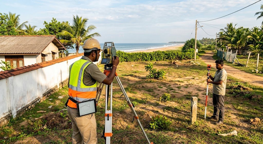
Most construction nightmares in Sri Lanka don't start with a bad contractor or a design mistake. They start with the land itself, and what nobody checked before building began. A boundary that doesn't match the deed, a right of way that was never legal, a slope that floods the foundation. A land survey is what brings all of this into the open before a single brick is laid, turning assumptions about a plot into confirmed facts you can actually build on.
This article walks through exactly what a land survey uncovers, the kind of findings that, left undiscovered, turn into delays, disputes, or costly redesigns once construction is already underway. If you're planning to build, these are the things worth knowing before you finalize your design or apply for approval.
1: Discover Boundary Lines That Don't Match the Deed
A deed tells you who owns the land. It doesn't tell you where that land actually starts and ends. That gap is where trouble begins.
In Sri Lanka, deeds are often based on old surveys, sometimes decades old, redrawn and passed down through several transfers. Each time a plan gets copied or referenced without a fresh ground check, small errors creep in. A boundary that looked fine on paper can shift once a licensed surveyor re-measures the actual plot.
A land survey re-establishes the real boundary using current measurements and the original survey markers, or pegs, placed in the ground. If the deed says one size and the survey shows another, you find out before you design a house, not after the foundation is poured.
This matters because your building plan, your setbacks, and your approval all depend on the real boundary, not the one written on an old deed. Building close to what you think is your boundary, only to find out later it belongs to someone else, means redesigns, disputes, or in the worst cases, demolition.
A survey settles this early, while it's still just a line on paper.
2: Discover Encroachments From Neighboring Land
Sometimes the problem isn't your boundary on paper — it's what's already sitting on the ground. A neighbor's wall built a foot too far, a fence shifted over the years, or a structure that quietly crept onto your plot long before you bought it.
These encroachments rarely show up just by looking at the land. A boundary can look perfectly normal to the eye while the actual survey markers tell a different story. Only a proper survey, checked against the registered plan, brings this to the surface.
Left unchecked, an encroachment becomes your problem the moment you buy the land. It's far easier to resolve while the previous owner is still involved than after the transfer is done and it's entirely on you to sort out with a neighbor.
This is also where construction plans quietly go wrong. Design and build around an encroached boundary, and you may end up with a structure that has to be altered, or a legal dispute that stalls the project entirely.
A survey catches this before you commit to a design, giving you the chance to resolve it, or walk away, while it's still simple to do either.
3: Street Line and Building Line Cutting Into Your Land
The plot size on your deed and the amount of land you can actually build on aren't always the same thing. Street lines and building lines can quietly cut into your land, and most buyers never notice until the design stage.
A street line marks land reserved for future road widening. A building line sets how far back from the road your structure must sit. Both are set by the local authority, and both can eat into a plot that looked fully usable on paper.
A survey identifies exactly where these lines fall on your land, along with the required setback distance. Without this, it's easy to design a house that uses the full plot, only to have the council reject it, or worse, approve it and later flag it as a violation.
This is more than a design inconvenience. Building over a street line can mean forced demolition of that portion of the structure if the road is ever widened. Building inside a building line can mean rejected plans and a redesign after money has already gone into architectural work.
A survey brings these limits into the open early, so your design is built around what you can legally use, not what you assumed you had.
4: No Legal Right of Way to the Land
A plot can look perfectly accessible and still have no legal right of way attached to it. The path you drive in on might belong to a neighbor who's simply never objected, or access that was informally allowed but never registered as a right.
This is easy to miss because physical access and legal access aren't the same thing. You can walk or drive onto a plot for years without any documented right to do so. That access can be blocked, restricted, or disputed at any point, especially once ownership changes hands or a neighbor decides to enforce their boundary.
A survey, read alongside the deed and title documents, shows whether the land has a registered right of way or depends entirely on a neighbor's goodwill. It also shows whether that access road is wide enough and properly connected to a public road, which matters for both daily use and construction vehicle access.
Discovering this after you've bought the land, or worse, after construction has started, leaves you negotiating from a weak position. Discovering it beforehand means it's still a solvable problem, not an emergency.
5: Drainage and Flood Exposure Tied to the Land's Slope
Land that looks flat and dry during a site visit can behave very differently once the rain sets in. A survey captures the actual slope and elevation of the plot, information a quick walk-through simply can't give you.
Every plot has a natural direction water moves in. On some land, water drains away cleanly. On others, it collects, sits, or flows in from higher neighboring plots. Without knowing which one you're dealing with, foundation decisions get made blind.
A survey maps these elevation points across the land, showing where it's higher, where it's lower, and where water is likely to pool during heavy rain. This directly affects how the foundation should be designed, whether the site needs filling or raising, and where drainage systems need to go before construction starts.
Skip this step, and the risk shows up later, as water pooling against the foundation, flooding during monsoon season, or damage that only becomes obvious after the house is built and lived in for a season or two.
Elevation data from a survey lets the design account for this from day one, instead of forcing costly fixes once the damage is already done.
Additional Discoverables
A few other findings worth knowing about, even if they apply to fewer plots:
- Coastal and Environmental Reservations: Land near the coast can fall within a reserved zone measured from the mean high water line, restricting what can be built and where. A survey flags whether your plot sits within one of these limits before you finalize a design around it.
- Utility Access Gaps: Whether an electricity pole is close enough to connect, or the land has enough space for a well if piped water isn't available, are practical details a survey can confirm alongside the boundary work, saving a separate trip and guesswork later.
- Outdated or Unapproved Survey Plans: A plan that's several years old, or was never approved by the local authority, may no longer reflect the land accurately, or hold up during the approval process. A fresh, approved survey replaces assumptions with something current and usable.
None of these are usually deal-breakers on their own, but each one is far easier to handle before construction starts than after.
Need Help Making Sense of Your Land Survey?
A land survey can flag problems, but knowing what to do with those findings is what actually protects your build. At Hello Builders, we help homeowners move from survey to blueprint with confidence, catching boundary, access, and setback issues early, before they turn into costly delays or redesigns.
Here's why homeowners trust Hello Builders with this stage:
- Survey-to-Design Coordination: We review your survey plan alongside your architectural design, so setbacks, boundaries, and access issues are addressed before construction starts, not after.
- Full Approval Support: From council submissions to UDA clearances, we handle the paperwork that depends on an accurate survey.
- One Team, Start to Finish: Architectural design, structural engineering, approvals, and project management, all under one roof, so nothing falls through the cracks between stages.
Don't let a land issue turn into a construction nightmare. Talk to our team before you break ground.
Conclusion
A land survey isn't a formality you get out of the way before construction starts. It's the one step that turns everything you assume about a plot, its size, its access, its limits, into something confirmed and buildable. The findings covered here rarely announce themselves during a site visit. They surface in a survey, or they surface mid-construction, when fixing them costs far more in time, money, and stress.
If you're planning to build, treat the survey as the foundation the rest of your project stands on, not a box to check. Get it done early, read it carefully, and let it shape the design before the design shapes your expectations of the land.
Key Takeaways
- A deed tells you who owns the land, not where its actual boundaries fall, and a survey confirms the real measurements.
- Old or repeatedly copied survey plans can carry small errors that only show up once a licensed surveyor re-measures the plot.
- Encroachments from neighboring walls, fences, or structures rarely show up by simply looking at the land.
- It's far easier to resolve an encroachment while the previous owner is still involved than after the transfer is complete.
- Street lines and building lines can reduce the amount of land you're legally allowed to build on, even if the full plot looks usable on paper.
- Building over a street line risks forced demolition if the road is ever widened.
- Physical access to a plot doesn't always mean legal access, and an undocumented right of way can be blocked or disputed later.
- A survey reveals the land's slope and elevation, showing where water is likely to pool before a foundation is ever built.
- Coastal reservations, utility access gaps, and outdated survey plans are smaller but still worth confirming before finalizing a design.
- Every issue a survey uncovers is easier and cheaper to solve before construction starts than after.
FAQs
What is a land survey plan in Sri Lanka?
A land survey plan is a certified document that shows a property's exact boundaries, size, and shape. It's prepared by a licensed surveyor and referenced in the deed, giving an accurate, ground-verified picture of the land rather than relying on ownership records alone.
How old can a survey plan be before it needs updating?
There's no fixed expiry, but local authorities often prefer plans under 10 years old. Older plans may not reflect current boundaries, encroachments, or road reservations, so it's worth getting a fresh survey done if you're planning to build or apply for approval.
Who is legally allowed to carry out a land survey?
Only a Registered Licensed Surveyor with a valid practicing license can carry out a legally recognized survey in Sri Lanka. A survey done by anyone else has no legal standing, especially if a boundary dispute arises later and the plan needs to hold up.
What happens if I build without checking the survey plan?
You risk building over boundaries, street lines, or setbacks without knowing it. This can lead to rejected building approvals, forced alterations, disputes with neighbors, or in serious cases, demolition orders once the issue is discovered after construction has already started.
How much does a land survey cost in Sri Lanka?
Costs vary depending on plot size, location, and complexity, so it's best to get a quote directly from a licensed surveyor. Budgeting for it early, alongside legal fees and approvals, avoids surprises later in the land buying or building process.